
Spooky Tree Mirrored
We were supposed to have a late start, but luckily the weather reporters cooperated by predicting afternoon rains. This put us on the road at 6:30 am, before sunrise, for a guided 9.7 mile hike in the mountains by Wrightwood with Jesper. Why guided? Sometimes it is just nice to show up and be told where to go without having to overly plan the hike for the day. I had planned on the Windy Gap-Mt. Hawkins-South Mt. Hawkins loop, which might have been too advanced for myself and my trail bitches, so it was postponed to another day eventually. So guided hike I chose, and so did 5 of my friends (TB – Susan, Shana; TS – Bill, Steve, Ryan), hopefully they realized they will be in a van for 3 hours that day and hopefully the hike makes it worthwhile. Empathy sucks sometimes! But it was a hike by Jesper, so of course he delivered!!
We are heading into those clouds
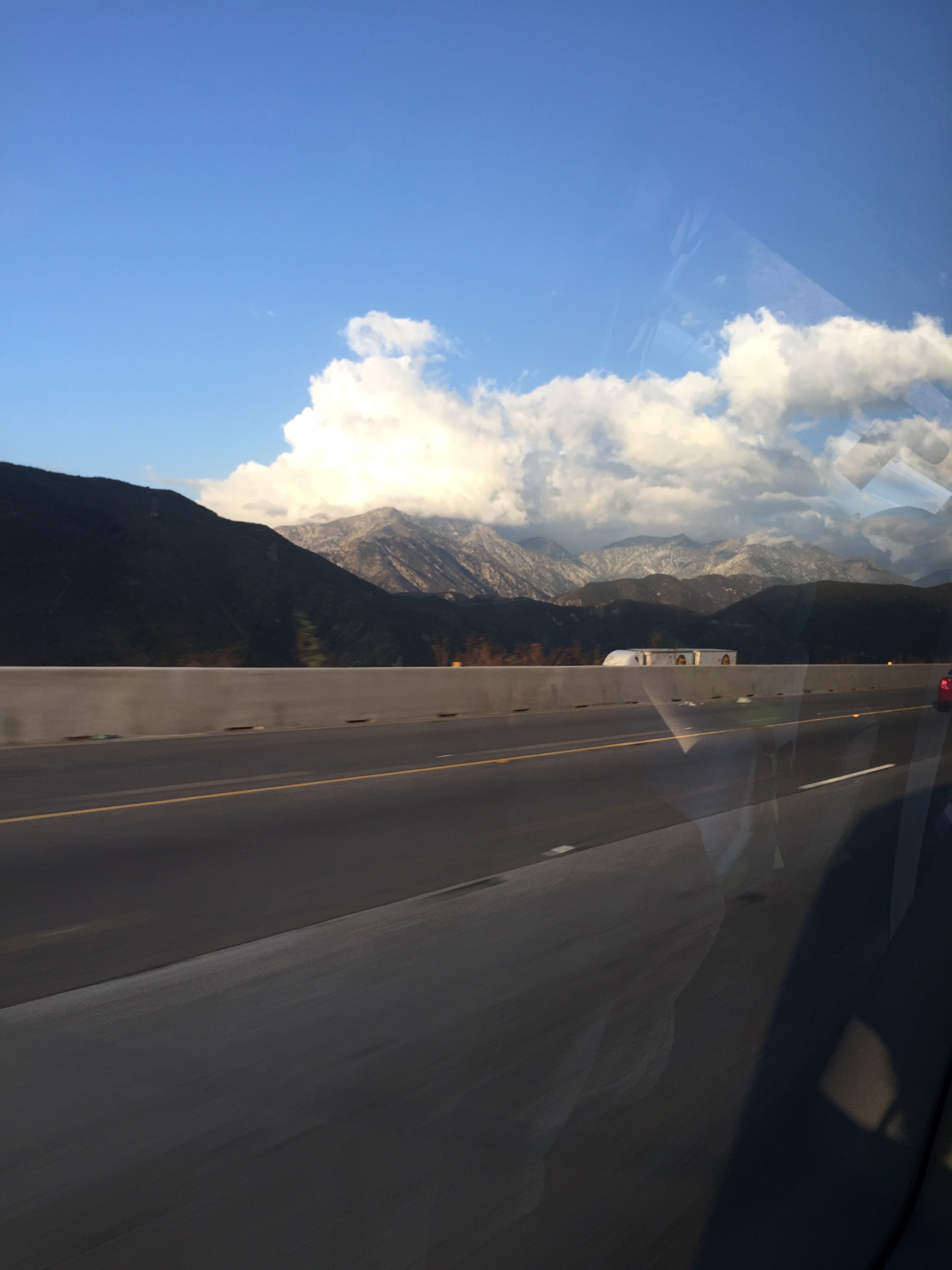
On our drive to Wrightwood the sun awoke, shining though the haze and giving us a glimpse of the cloud covered mountains in the San Gabriels. We decided not to take the Interstate 10, as it was backed up a bit. Luckily for Jesper the 15 was wide open and we continued up the 138 to the 2, to the tiny town of Wrightwood. He gave us peek at the pub that we would accumulate at after our hike, maybe recognizing that we needed a “carrot” to drag our asses up a mountain? Mammoth IPA, anyone?
Upon arriving at our trail head, Blue Ridge, we unloaded, suited up, used the facilities, which by the way, were surprisingly very nice. BTW I am trying a new pair of hiking shoes, Vasque, same brand as my hiking boots, one half size bigger than the Keens, which I easily returned to REI. Love REI! Jesper passed out the walkie talkies to several hikers, so we could be in constant contact if we separated from each other.

The motley crew – Lewis, Myself, Steve, Bev, Rita, Bill, Shana, Ryan and Susan
He then gave us some hiker ground rules, love this, perhaps I should start my hikes with ground rules and maps, then Shana wouldn’t take wrong trails or fall down mountain sides. Learning things all the time!  We set off and no sooner than a couple of steps, I realized I again forgot to set the Walkmeter app and note my step count. Steve helped me remedy this issue, and we jogged a little to catch the tail end of the group. Yes, jogged, ha I know, that sounds funny, but we did!

We had sun for a little while

NIce view huh? Wink wink!
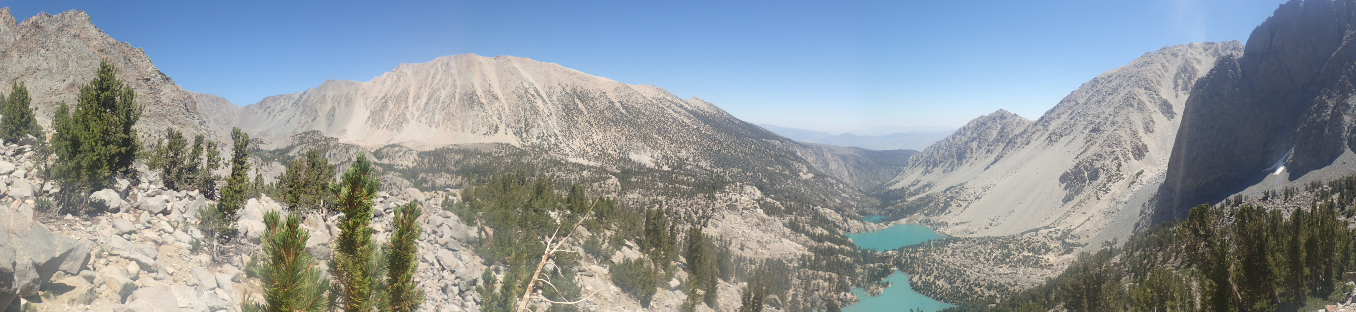
The Blue Ridge Trail is a nice moderate trail, with ups and downs, and at this time of the year, beautifully decorated with the changing color of the leaves.

First official rest stop
About a mile into the trail we came upon a bench where we all regrouped and then continued another mile up to the Blue Ridge campground, which was right next to a Mountain High chair lift. By the time we hit this campground, we had hiked into the clouds and the sun was no longer visible. We took a small break at this site, which has a restroom.

Gazelle galloping back to find us!

Stop chit chatting and move on!!
At this point, without Jesper, I would be perusing my map, looking confusingly at my compass (actually I don’t have this essential yet), and trying to determine what direction we should go. But we had Jesper!! Yeah!!! So he proceeds with our next direction of heading up the ski run…not so “yeah” any more. What?! Susan and I don’t hike up ski runs! Maybe sometimes involuntarily with our skis on, waddling up to help a fallen comrade or retrieve a pole, but to walk up a ski run voluntarily?  Looking up to the task at hand, one wonders, is this an expert run, maybe an intermediate run, where are the switchbacks, I don’t think we are allowed to hike here? Sigh. Continuing up, walking under a chair lift, OMG hello, we should be in one of those chairs; we would be sitting there hitting the flask, drinking a little yummy shot, sucking on a fire rancher, yes I digress. Okay, so we made it, as it wasn’t that bad, one foot in front of the other. I have to whine a bit.
Whose idea was this? However at the top, there is a sign that shows that a beginner run was to the right of us…just pointing that out.

Sorry closed for the summer!

Reservoir at the top of Mountain HIgh

No bikers!!!
So we gather at the top where we find a chalet type building, drinks anyone? We followed our fearless leader around the water reservoir to find the PCT trail. Yeah!! Now this was one of my favorite parts, it is fairly flat, not too many trees, and a low cloud coverage which brought in a fog like spookiness to our hike; it is October!

Ghost stories anyone?

Not a lot of trees, kinda spooky…

Bottom of a hollowed out tree stump
Eerily peaceful, I was able to take a couple of cool photos, which BTW is why I am always last, trying to capture the memories (or my breath). PCT trail led us to Guffy Campground, which surprisingly had a lot of campers (trucks) in it. We didn’t see any people, as apparently they were all out hunting. For what, I didn’t really care to know. Jesper actually almost didn’t see a camouflaged hunter tucked into a tree well, but the bright cap to his water bottle gave him up. Kinda freaky! We stopped here for a partial lunch break, roasted chicken salad with cranberries, celery, carrots, walnuts, spinach, tomatoes on fresh rolls. Yeah, all about the food!!

Lunch at Guffy Campground – just toilets, apparently no trash cans and no running water.

Bellies full and ready to forge on…
We chatted a bit about the turds who think the world is their trash can. They left batteries, paper, balloons, etc. all over the campsite. Complete losers! After lunch, we continued along the PCT trail until we came to a junction, where Jesper gave us a choice, go down to town or go up about ½ mile to the top of Wright Mountain. Although the nice frosty IPAs were calling, we all elected the peak. However, we were not sure if we could find the trail head, as we previously we ran into a couple of hikers coming the other way and they said they missed the trail cut off to Wright Mountain.

Spot of sunlight hitting the mountainside

Stay on the trail Steve

Still on the PCT

At the Acorn Trail Junction

Trail up to Wright Mountain, lucky for you, this is a picture, and not a video…

Cool red flowers on the trail…
So we pressed on, searching for the trail, which we found, which was not marked. This trail was a doozy, quite steep and quite bushy, but luckily for us, it was fairly short. Once on top we had great views of Wrightwood and neighboring mountains, NOT! It was a sheer drop off the top with a view of a big ass cloud. So we took our prerequisite photos and headed back down to the junction where we would descend via the Acorn Trail.

Our fearless leader

Looking down into the abyss.

Don’t do it!!

Since we are all following Jesper, we are all Trail Bitches today, Shana you look like a giant!!

I think I am taller??

Steve and Shana – Christmas Photo?

Bill and Susan, one more step back please…

Colorful bunch

Jesper’s cairn
When we come back to the PCT, Jesper built a cairn (or duck as some people say) marking the trail to Wright Mountain. It would be interesting to see if it is still there next year…
We gathered at the junction of the PCT and Acorn Trail prior to heading down, some elected to start the dreaded down, some elected to rest, chat and eat, Shana, Steve and I were part of the latter. It was at this point, Shana and I decided to relieve ourselves. Very thought provoking, as I am not shy and could easily drop trow and my Scandinavian ass where I was currently standing, but I am willing to find a tree to “hide” behind. However at this junction, we had the PCT coming in both directions with the Acorn Trail branching downward, so finding a tree without a trail view was pretty impossible. Shana found her tree away from the group, fleetingly I thought about plopping down right next to her, but that could be construed as creepy. So I ventured to the next tree, looked around, mentally apologized to any hiker/hunter that may get a slightly obstructed view of my ass and I squatted into chair position (thank you yoga) and took care of business! Although I don’t think bears or deers have asses as white as mine, I am lucky no one ventured down the trail, especially one with a gun… or maybe they were the lucky ones.

Pretty rock, picture for Susan!!

Pretty trail

Why does one tree die? To make my photo awesome?

Just beautiful
Now Acorn Trail is 2.7 miles to the trailhead in town with an elevation change of 2000 feet. Baden Powell trail was 4 miles with an elevation change of 2800 feet. This makes the Acorn Trail a pretty steep descent, making my toenails cringe. Many different colors of slate covered this beautiful trail, blues and greens mixed in with the changing colors in the dirt and the trees, so hard to describe. Pictures don’t do it justice. We eventually caught up to Ryan and Susan towards the bottom of the trail taking a quick break.

The trail marker at the beginning of the actual trail
We all rendezvoused at the marker for the Acorn Trail before continuing down in to town. Paved roads took us through the neighborhood of Wrightwood and it was here that the clouds decided to let loose. Rain!! Love it! Took a while for me to take out the raincoat because it was such a foreign feeling of water and cold, I needed to soak it in. No pun intended!

Wet Wrightwood neighborhood

Pretty colors of fall

Village Grind – beers on tap!!
We all made it to the Village Grind where some had that well deserved IPA or some other tasty beverage, relaxing and listening to a band on the patio. Time to head back to chaos…waze put us back in Irvine at 4:30 pm. Thank you Jesper! Fantastic day!

Heavenly ending at Pine Ridge
Of course the day ended with a great dinner and two bottles of Pine Ridge, heavenly!
Stats: 27,568 steps, 271 flights of stairs, 1 liter of water (not good), 0 blisters, 2 bottles of wine – wine is bottled poetry!